


Center Voting District, Lawrence County, Mississippi
About
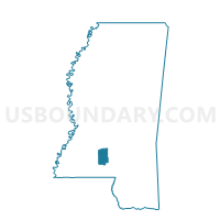
Outline

Summary
| Unique Area Identifier | 605986 |
| Name | Center Voting District |
| County | Lawrence County |
| State | Mississippi |
| Area (square miles) | 8.22 |
| Land Area (square miles) | 8.22 |
| Water Area (square miles) | 0.00 |
| % of Land Area | 100.00 |
| % of Water Area | 0.00 |
| Latitude of the Internal Point | 31.48333790 |
| Longtitude of the Internal Point | -90.20758720 |
Maps


Graphs
Select a template below for downloading or customizing gragh for Center Voting District, Lawrence County, Mississippi


Neighbors
Neighoring Voting District (by Name) Neighboring Voting District on the Map
- Cooper's Creek Voting District, Lawrence County, MS
- Courthouse Voting District, Lawrence County, MS
- East Lincoln Voting District, Lincoln County, MS
- Topeka Voting District, Lawrence County, MS
Top 10 Neighboring County Subdivision (by Population) Neighboring County Subdivision on the Map
- District 1, Lincoln County, MS (5,410)
- District 3, Lawrence County, MS (2,845)
- District 1, Lawrence County, MS (2,588)
Top 10 Neighboring Unified School District (by Population) Neighboring Unified School District on the Map
Top 10 Neighboring State Legislative District Lower Chamber (by Population) Neighboring State Legislative District Lower Chamber on the Map
- State House District 92, MS (26,069)
- State House District 53, MS (22,266)
- State House District 91, MS (20,672)